SimActive and Correlator3D™: A Closer Look Drone mapping has transformed industries by making geospatial data more accessible. However, achieving high-quality results requires both the right tools and the right approach. DRONELIFE.com interviewed Eric Andelin, Senior Workflow Specialist at SimActive, to...
Tag: Featured – Surveying
New Drones in India: Surveyaan V1 Receives Certification
Surveyaan V1 Drone by Nibrus Technologies Receives DGCA Type Certification New Certification Marks a Milestone for India’s Drone Industry Nibrus Technologies, a drone manufacturer in India, has announced that its Surveyaan V1 drone has received Type Certification from the Directorate...
DroneDeploy on the State of Reality Capture: Trends, Adoption, and Future Prospects
DroneDeploy’s Groundbreaking Survey Reveals Rapid Growth, ROI Insights, and Optimistic Projections in Reality Capture Technology by DRONELIFE Staff Writer Ian J. McNabb In recent years, reality capture and photogrammetry have been rapidly gaining traction. Accurate mapping and data capture are...
Skydio, Trimble Partner to Bring Centimeter Level Accuracy to the X10
Skydio and Trimble Collaborate on New Integration for Utilities, Construction and State Transportation Agencies by DRONELIFE Staff Writer Ian J. McNabb Skydio, a California-based drone and UAV manufacturer focused on autonomy, recently announced a new strategic partnership with Trimble to...
Trinity Pro Integrates Phase One P5 128 Megapixel Camera for a Survey Grade Drone Solution
Quantum-Systems GmbH, a leading Munich-based drone manufacturer, has unveiled an innovative survey-grade UAV solution in collaboration with Phase One and Trimble. The Phase One P5 128-megapixel camera has been seamlessly integrated into Quantum Systems’ flagship Trinity Pro mapping drone, marking...
LiDAR Surveying Drone Made in the US: Microdrones Adds Alabama Manufacturing Site
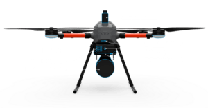
Microdrones to Sell Drone Surveying Equipment Designed and Made in the US Starting in 2024 by DRONELIFE Staff Writer Walker Robinson Microdrones has announced that they will be opening a manufacturing factory in the United States to meet the growing...
GeoCue Partners with Tediris to Integrate TrueView 3D Imaging with Aero 4 Drone
GeoCue and Tediris Solutions Partner to Provide Spain with Aerial Mapping Solutions by DRONELIFE Staff Writer Ian M. Crosby LiDAR mapping leader GeoCue has announced a new partnership with Spanish drone service provider Tediris Solutions. With close to a decade...
Mapping Paradise: Event 38 and PLACE Partner to Map Turks and Caicos
Event 38 and PLACE Partner to Map Turks and Caicos Islands Using E400 Drones by DRONELIFE Staff Writer Ian M. Crosby Mapping drone manufacturer Event 38 Unmanned Systems has announced the successful deployment of its E400 fixed-wing mapping drone for...