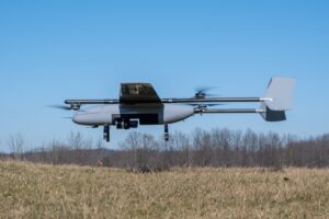
Surveyaan V1 Drone by Nibrus Technologies Receives DGCA Type Certification New Certification Marks a Milestone for India’s Drone Industry Nibrus Technologies, a drone manufacturer in India, has announced that its Surveyaan V1 drone has received Type Certification from the Directorate...
Tag: Surveying
Pix4D Releases Enhanced PIX4Dcatch 2.0 with AR Features
Latest update integrates professional augmented reality tools for improved precision in AEC sectors. Swiss-based Pix4D, a leading provider of drone and terrestrial mapping solutions, announced today the release of the upgraded version of their mobile scanning app, PIX4Dcatch 2.0. This...
Event 38 Unmanned Systems Incorporates Advanced LiDAR Technology into E455 Drone
Event 38 Unmanned Systems Integrates Advanced LiDAR onto E455 Drone Event 38 Unmanned Systems, a global leader in the manufacturing of unmanned aerial vehicles, has announced a significant upgrade to their Heavy VTOL E455 Drone. The drone can now be...
Skydio, Trimble Partner to Bring Centimeter Level Accuracy to the X10
Skydio and Trimble Collaborate on New Integration for Utilities, Construction and State Transportation Agencies by DRONELIFE Staff Writer Ian J. McNabb Skydio, a California-based drone and UAV manufacturer focused on autonomy, recently announced a new strategic partnership with Trimble to...
GeoCue Partners with Tediris to Integrate TrueView 3D Imaging with Aero 4 Drone
GeoCue and Tediris Solutions Partner to Provide Spain with Aerial Mapping Solutions by DRONELIFE Staff Writer Ian M. Crosby LiDAR mapping leader GeoCue has announced a new partnership with Spanish drone service provider Tediris Solutions. With close to a decade...
Mapping Paradise: Event 38 and PLACE Partner to Map Turks and Caicos
Event 38 and PLACE Partner to Map Turks and Caicos Islands Using E400 Drones by DRONELIFE Staff Writer Ian M. Crosby Mapping drone manufacturer Event 38 Unmanned Systems has announced the successful deployment of its E400 fixed-wing mapping drone for...