PIX4Dfields 2.8: XAG prescriptions, AI crop report and more!
PIX4Dfields 2.8 delivers precision XAG VRA & spot spraying prescription maps, AI-driven crop growth reports, 15-band sensor support, & more!
Revolutionary flight control with XAG spray drones
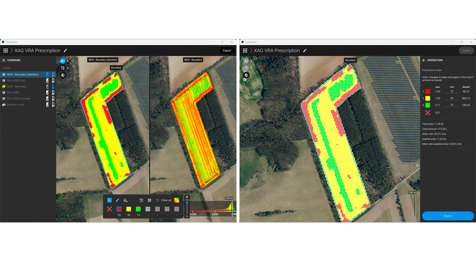
The new export format for XAG spray drones is specifically designed to enable variable rate (VRA) and efficient patch spraying applications. XAG drones can now seamlessly interpret VRA prescription maps to avoid unnecessary coverage and reduce usage of agricultural inputs.

Area rates assigned for variable rate nitrogen application (right) based on NDVI index (left) in PIX4Dfields
This new feature allows XAG drones to adjust flight plans based on prescription maps created in PIX4Dfields, skipping areas that do not require application. The drones will intelligently navigate across fields, targeting only the zones that need treatment, this promotes significant time and resource savings while reducing the ecological impact of day-to-day operations!

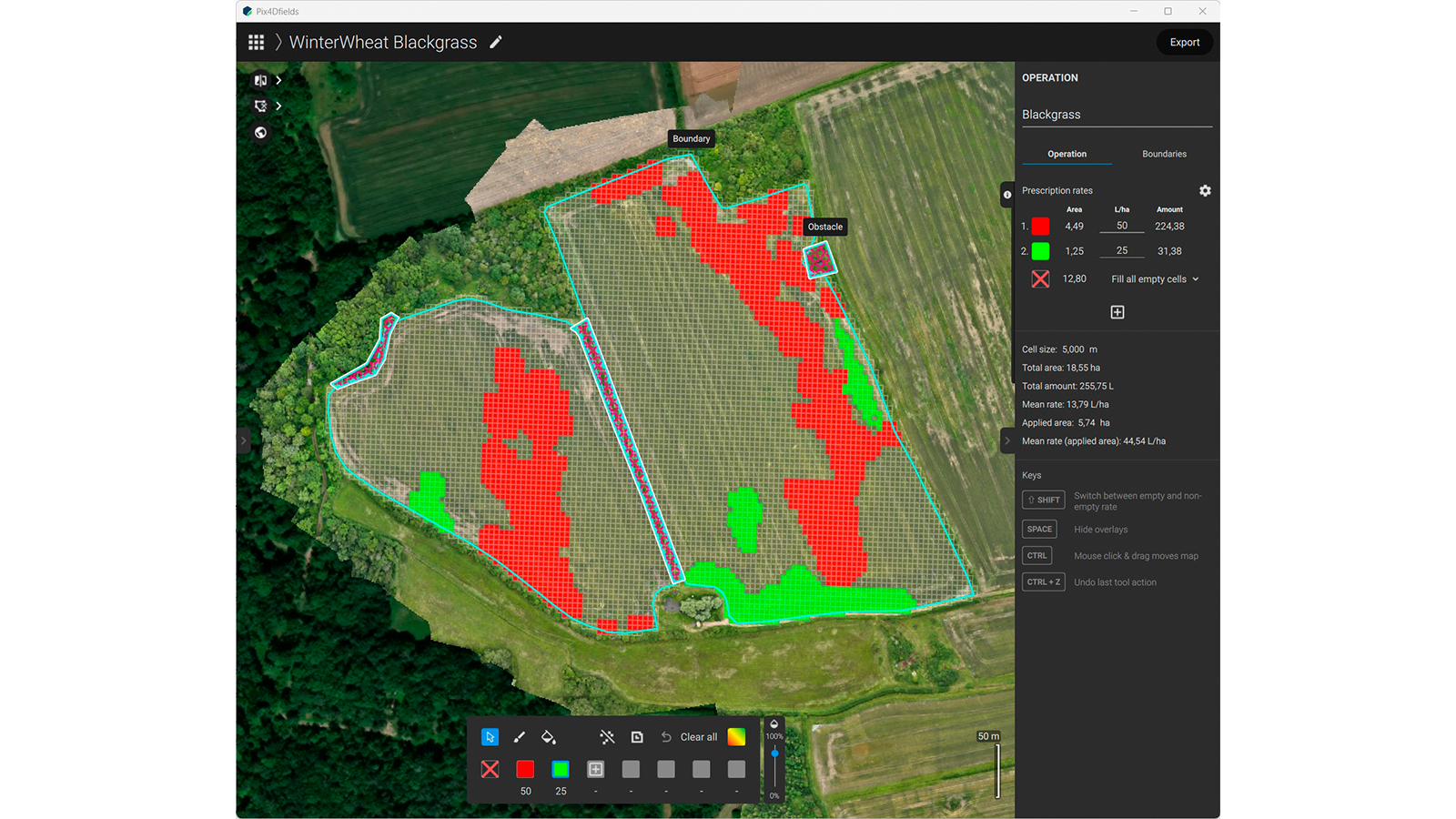
XAG VRA mission export in PIX4Dfields
Key benefits of the new export format include:
- Improved precision: automatically adjusts flight paths, ensuring accurate application only where needed
- Increased efficiency: reduces input usage and flight time, driving sustainability in farming practices
- Site-specific applications: adapt prescription rates in-flight based on crop health data
Learn more from our support article.
AI crop growth status report
The latest update brings field insights (beta feature) that assist users in interpreting NDVI (Normalized Difference Vegetation Index) maps related to crop health. It integrates multiple types of data—such as crop growth stages, weather patterns, soil conditions, and NDVI-derived vegetation health—all into a comprehensive, written field report.
This feature supports informed decision-making in agricultural practices and simplifies record-keeping.
Learn more from our support article.
Superior crop insights with Agrowing sensors
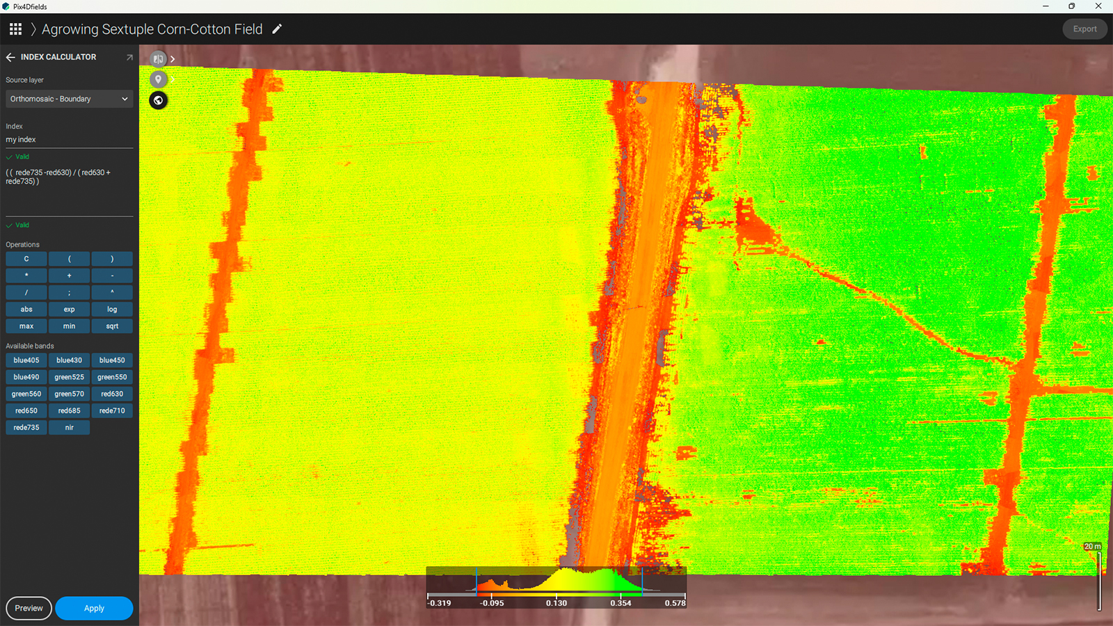
PIX4Dfields now supports Agrowing’s Quad (11 narrow bands of 12MP each) and Sextuple (15 narrow bands of 7.2MP each) multispectral sensors. The sensors’ camera body (Sony ILX-LR1) can be used with a Cipi-In IR-cut filter as a 61MP RGB mapping camera! Using PIX4Dfields’ custom index calculator, Agrowing’s sensors offer a wide range of vegetation indices for plant stress, disease and weed detection at incredible resolution and mapping speeds.

Vegetation index generated in PIX4Dfields from corn crop images captured with Agrowing’s Sextuple camera.
Expand application zones with the new Buffer tool
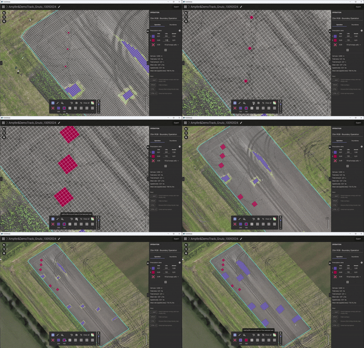
The application zones for Targeted Operations can now be expanded with the new Buffer tool when a larger application area around targets is required. This feature is particularly useful for spot spraying, enabling a broader coverage area around targeted spots to ensure effective application, even with less precise machines. Additionally, it proves advantageous when importing point data for prescription use.

Applying the Buffer tool during the prescription map creation in PIX4Dfields
Download PIX4Dfields 2.8 today
Related
Discover more from sUAS News
Subscribe to get the latest posts sent to your email.


